Bryce Canyon National Park
We traveled next to Bryce Canyon National Park, another highlight of our trip. On our way, we made a quick photo stop to see Balanced Rock. It is near Lee’s Ferry in Marble Canyon. The National Park Service explains how it came to be:
Thousands of years ago a huge rock boulder broke from the cliff above and tumbled to a stop here. The hard conglomerate boulder compressed the softer dirt directly beneath, making it resistant to erosion. The boulder also acted as a massive umbrella, protecting the stone beneath from years of wind and rain. Over time, at least 6 feet of the surrounding loose ground was carried away, leaving an ever-growing pedestal with a balanced rock perched on top. At some point, the sheltering boulder may become too much weight for its pedestal, toppling and taking another fateful tumble.
https://www.nps.gov/places/balanced-rock-at-lees-ferry.htm

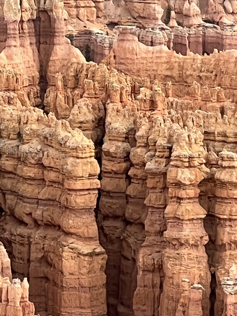
We arrived at Bryce later that afternoon. This national park is famous for its hoodoos, strange pillars seeming to grow from the ground below. They are actually a geological formation. The National Park Service explains the circumstances allowing for their creation:
“Weathering is the breaking down of rock (while) erosion is the transportation of that broken rock. These two forces of nature work in concert to sculpt Bryce Canyon’s hoodoos. The main natural forces of weathering and erosion that create the Hoodoos are ice and rain. The elevation in which Bryce Canyon is located receives both above freezing temperatures and below freezing temperatures over 170 nights out of the year…This is crucial to creating the Hoodoos. When water (from either rain or snow that has melted) seeps its way into the cracks in the rock, it resides there. Hours later, when Bryce Canyon is met with freezing temperatures, the water trapped inside the rock begins to freeze into ice. When water freezes into ice, it expands by 9%! This expansion into ice causes tremendous pressure on the surrounding rock, and thus causes it to break apart. This process is known as ice wedging, because the ice is literally wedging apart the rocks…Eventually the rocks break down into walls, windows, and then as individual hoodoos.”
https://www.nps.gov/brca/learn/nature/hoodoos.htm
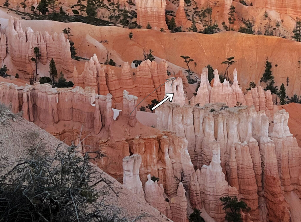
This process takes place in steps. Hoodoos are eroded out of cliffs. As the cliff walls are eroded, they become thinner until they are called fins. The ice wedges make cracks in the fins that look like a window (see picture below). As the window becomes larger, the top collapses leaving a column. Rain dissolves more of the limestone column, giving the hoodoo its unique shape.
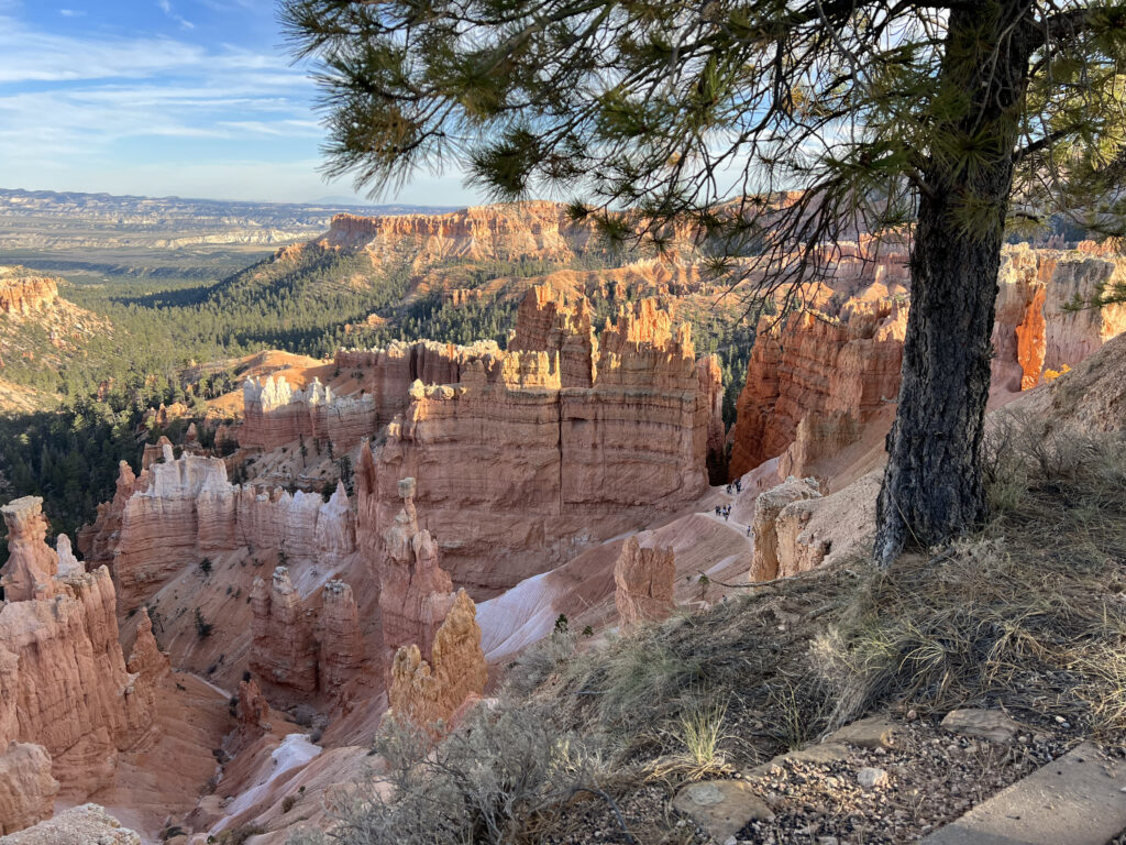
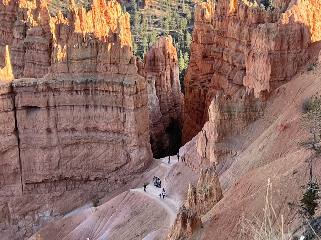
The pictures below were our first views of Bryce Canyon National Park and were taken at Sunset Point. The pictures with people hiking below us give you a sense of the height of the hoodoos. The ones in Bryce range from five feet to 150 feet tall. A few people in our group hiked where you see the people in the pictures – that was a bit too ambitious for us.


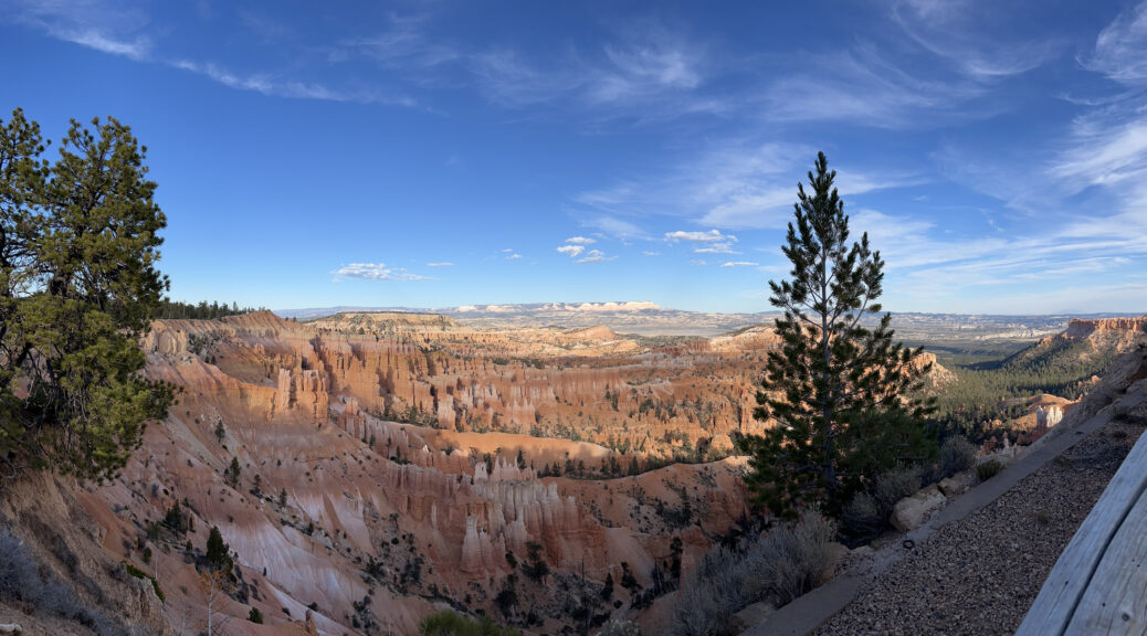
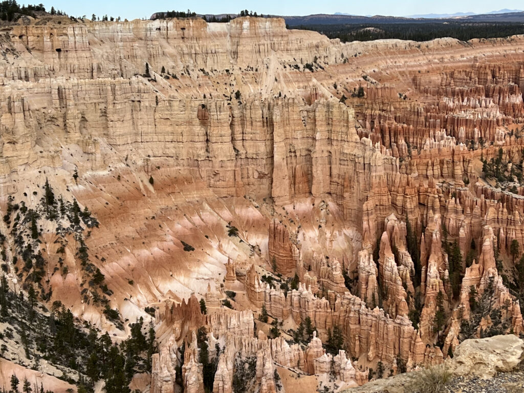
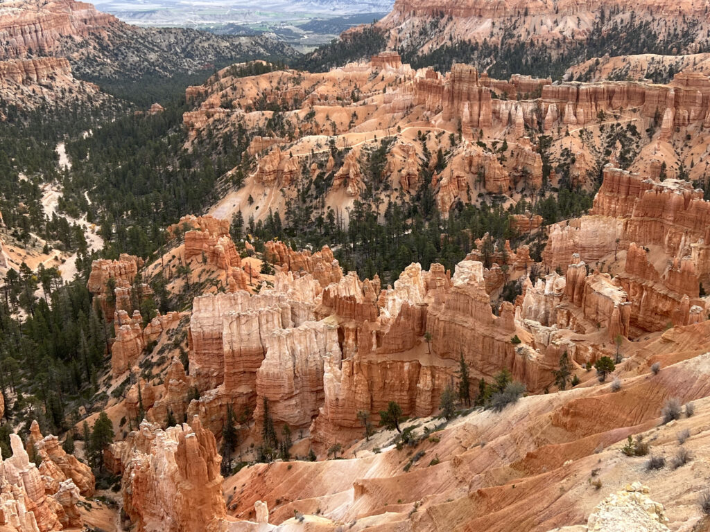
After breakfast, we met people from our group for a bus ride to Bryce Point at an elevation of 8,300 feet. These are pictures we took while we were there. The different colors in the rock are due to different minerals.

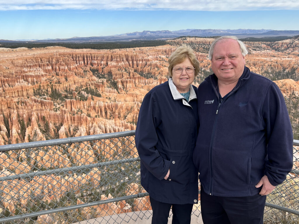
We next went to Inspiration Point with an elevation of 8,100 feet. As you can see, the hoodoos make Bryce Canyon a very unique and beautiful place.


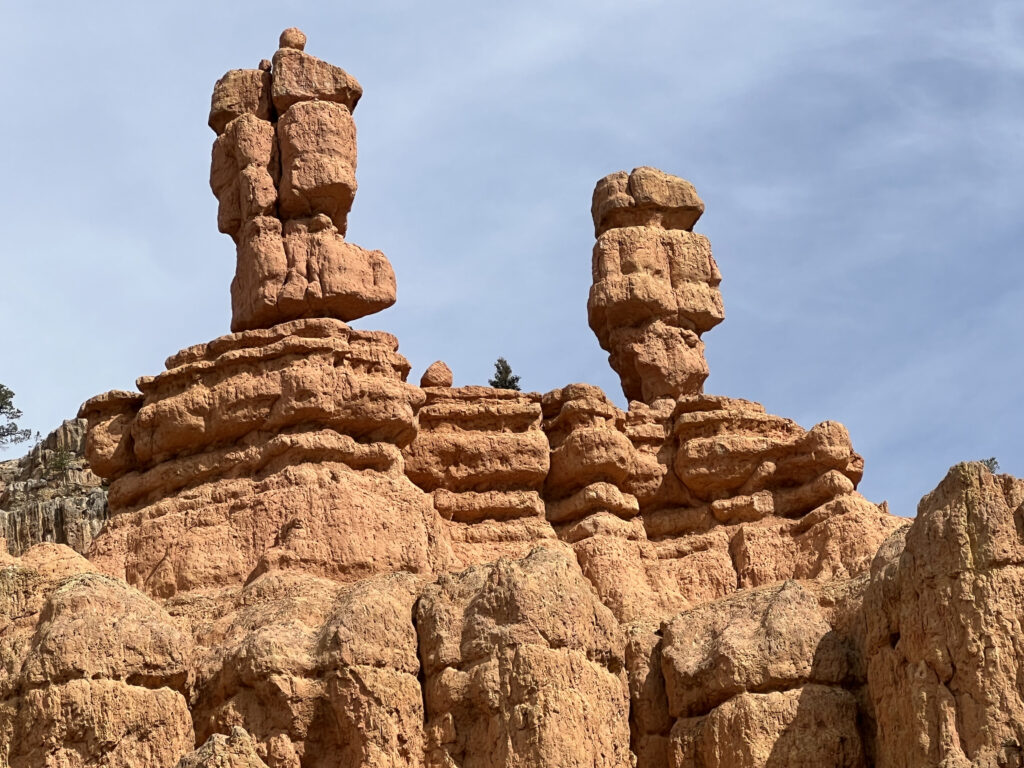
As we drove toward Zion, the next park we would visit, we saw another interesting rock formation. These are known as Salt and Pepper. Pepper is the one on the left with a knob at the top. These are also hoodoos. Needless to say, we learned a lot of geology on this trip!