By Air, Land and River
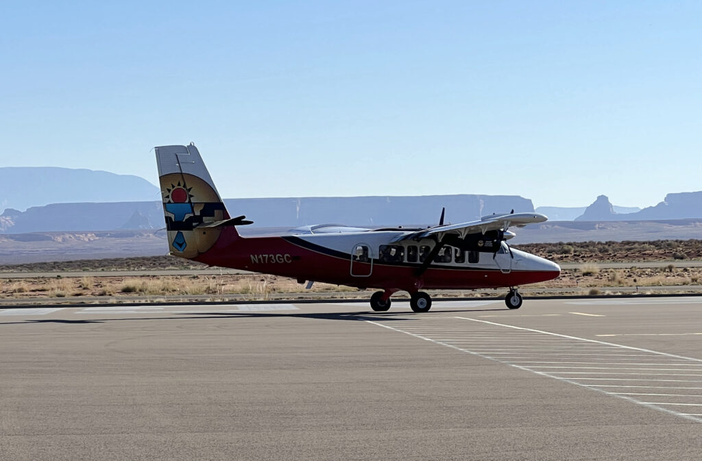
After leaving the Grand Canyon, we drove to the Glen Canyon and Lake Powell area, where we had a half hour flightseeing experience. We were on a small plane holding about 12 passengers, each of us with a window seat. The afternoon before, we had visited the Carl Hayden Visitor Center adjacent to the Glen Canyon Dam. The Visitors’ Center was named for Senator Carl Hayden who at the time was the longest serving member of Congress – in fact, he was first elected when Arizona became a state. He was influential on important matters to the state including reclamation, power, highways, and irrigation.
On this day, we had the opportunity to see the dam from the air. The Glen Canyon Dam sits on the Colorado River near Page, Arizona. It is 710 feet high and was built between 1955 and 1966. The dam formed Lake Powell, the largest man-made reservoir. The dam is named for Glen Canyon, some of whose sandstone gorges were flooded as a result of the dam.
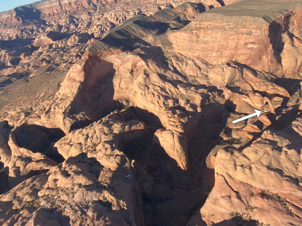
Another iconic landmark we saw was the Rainbow Bridge. It is on the far right in my picture, with a white arrow pointing it out. As small as it looks from the air, it is actually the largest natural bridge in the world. It is 290 feet tall and 270 feet wide.
Rainbow Bridge is considered sacred by the Navajo culture as a symbol of deities responsible for creating clouds, rainbows and rain – the essence of life in the desert…One of the natural wonders of the world, the bridge has been formed by erosion of the sandstone by water flowing from Navajo Mountain towards the Colorado River.
https://www.utah.com/destinations/national-monuments/rainbow-bridge-national-monument/#readmore

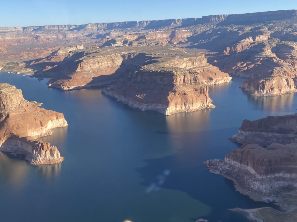
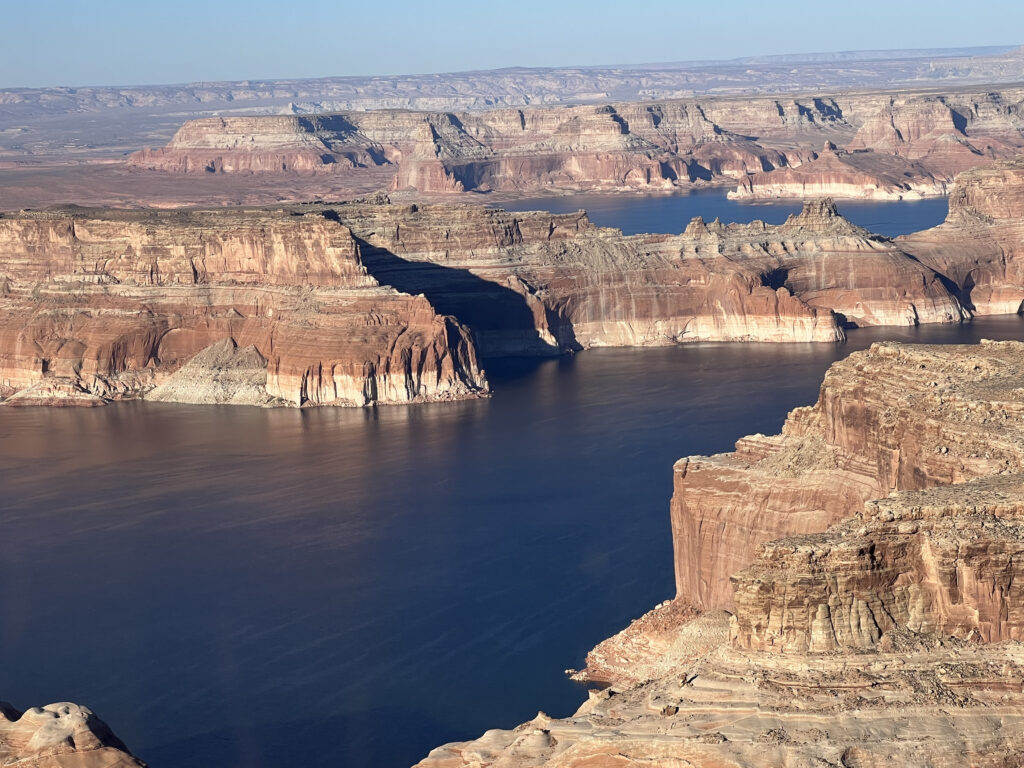
The next pictures are of Lake Powell and some of the sandstone walls we saw during our flight. The Lake was named for John Wesley Powell who was a Civil War veteran and geologist. Despite losing one arm in the war, he explored the Colorado River in 1869. Lake Powell is a major recreation area and plays a critical role in providing water to several states, including Colorado, Utah, Wyoming, New Mexico, Arizona, Nevada and California.

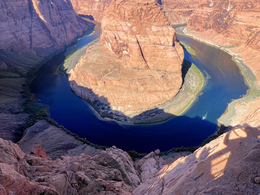
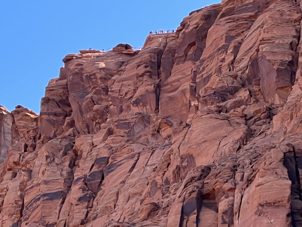
After our flightseeeing adventure, we traveled a short distance to see Horseshoe Bend. It is shaped like a horseshoe and is a result of the meandering of the Colorado River. We hiked just over a half mile to a fenced lookout area, about 1,000 feet above the River. The return hike was a bit more up-hill and we took advantage of shaded benches to rest occasionally on our return. The next day we would take a float trip down the Colorado River and actually make our way around this Bend. I took the second picture from our raft, looking up at the lookout area where we had initially viewed Horseshoe Bend.
The next morning we took a float trip down the Colorado River. The trip began near the Glen Canyon Dam and went to Lee’s Ferry, about 15 miles from where we began. This is the “calm” part of the Colorado River. Because of the importance of the dam, Homeland Security is responsible for assuring its safety. We went through security and then boarded a special bus that took us through a two-mile tunnel until we were about 800 feet below grade, very near the base of the dam. We then walked a short distance where we boarded our raft.
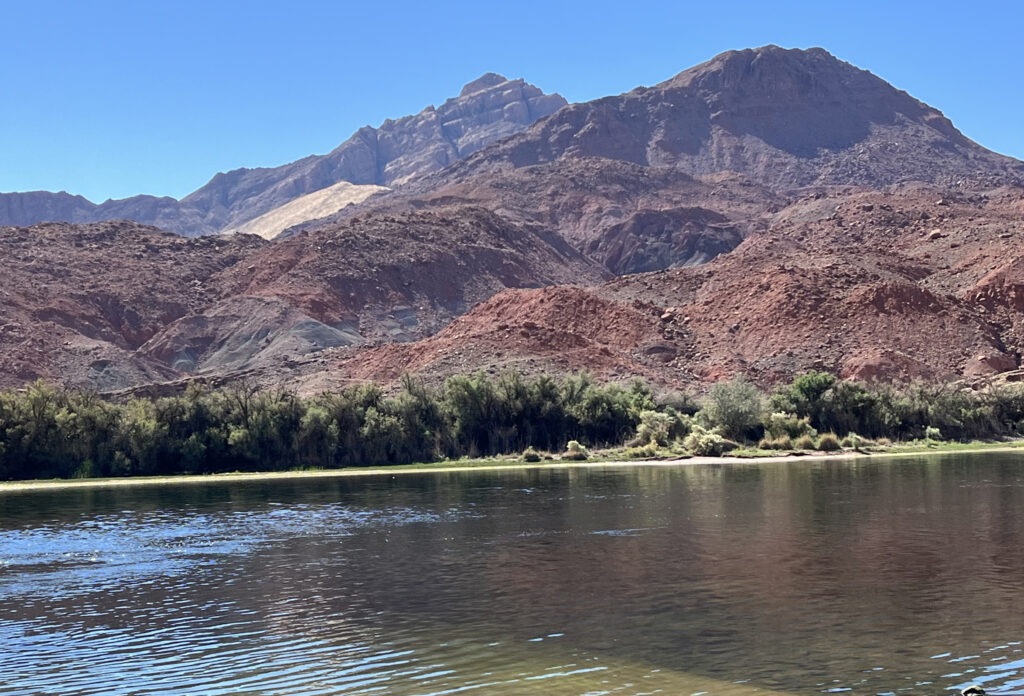
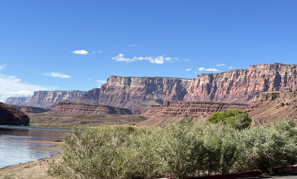
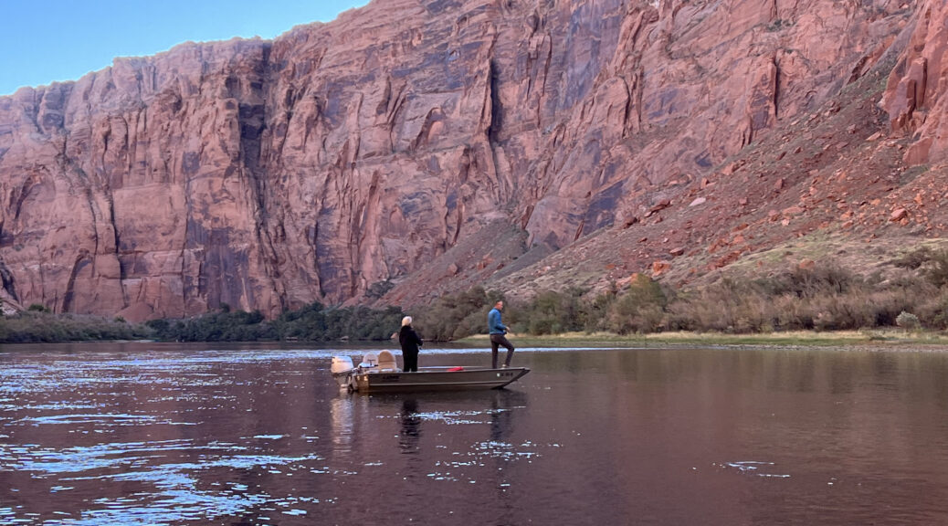
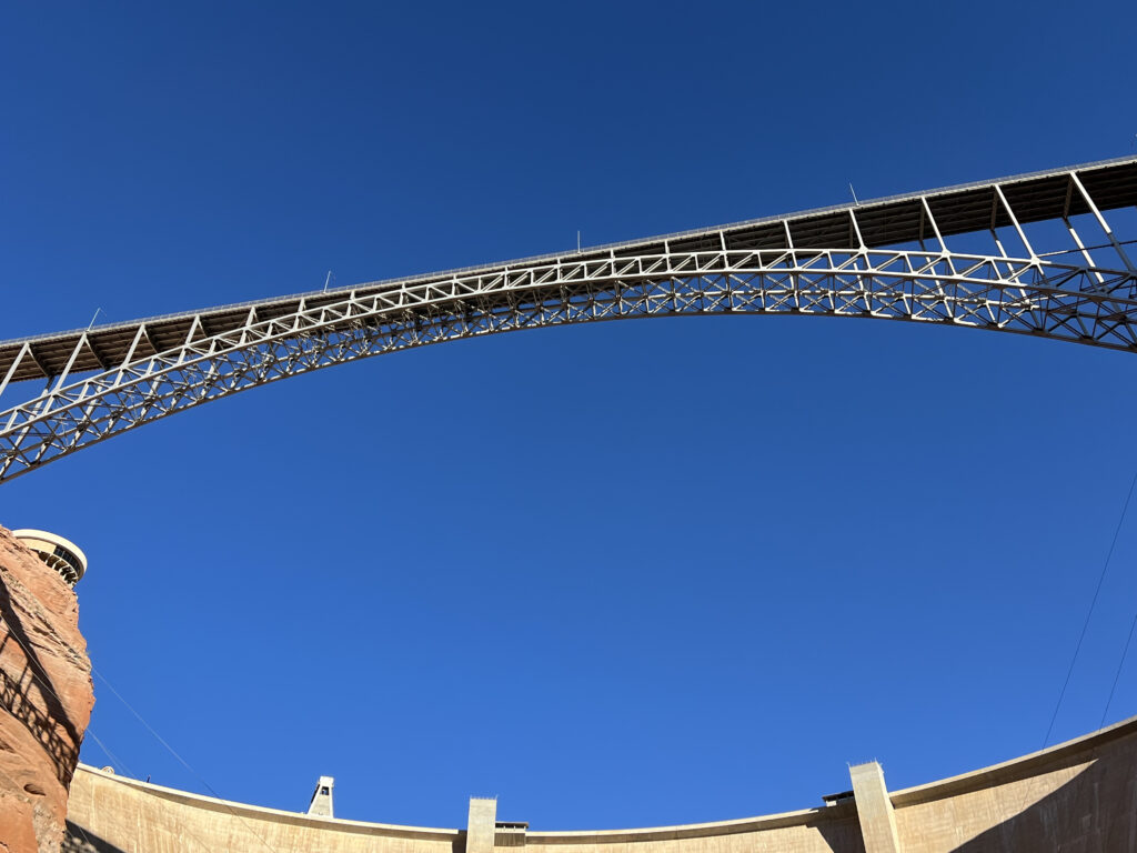
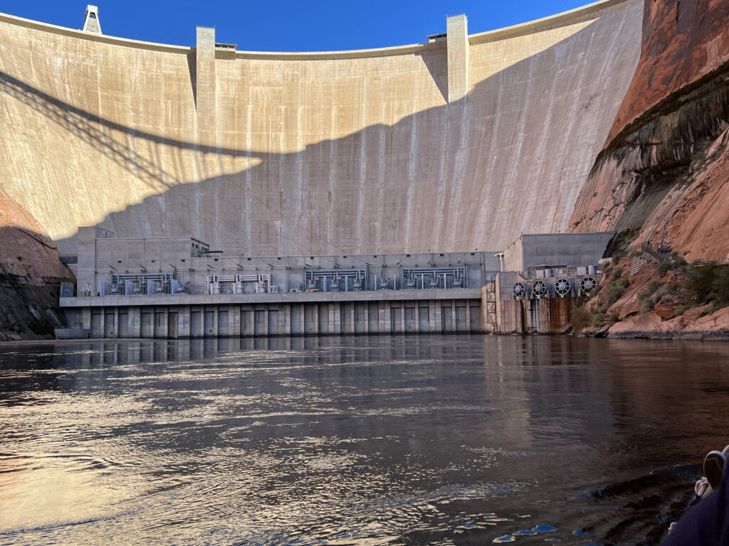
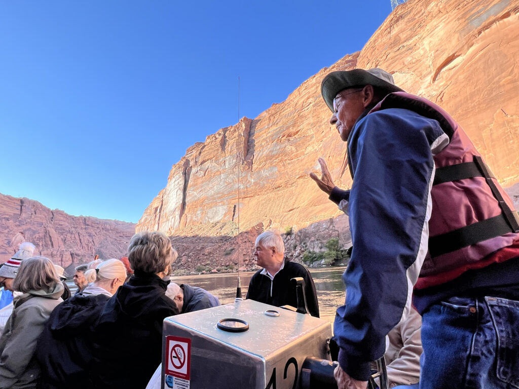
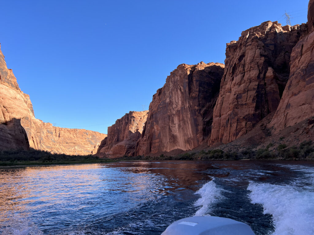
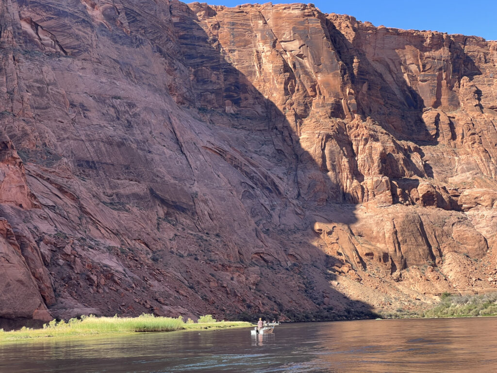
Pictured below is the Glen Canyon Bridge and the Glen Canyon Dam. On the other side of the dam, the water level is about 400 feet higher than where we were in the raft. Our “captain” and guide was a great storyteller and also happened to be the mayor of Page. I have included additional pictures of the River and Canyon. In the last one, note the small fishing boat. It provides perspective as to the height of the canyon walls.

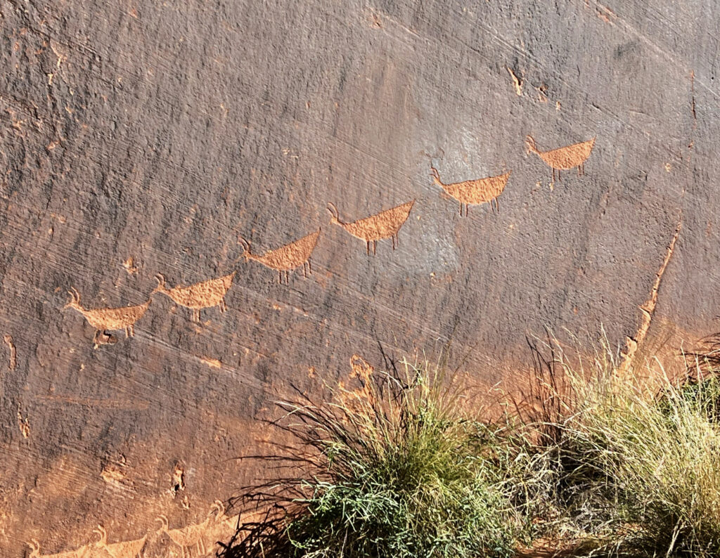
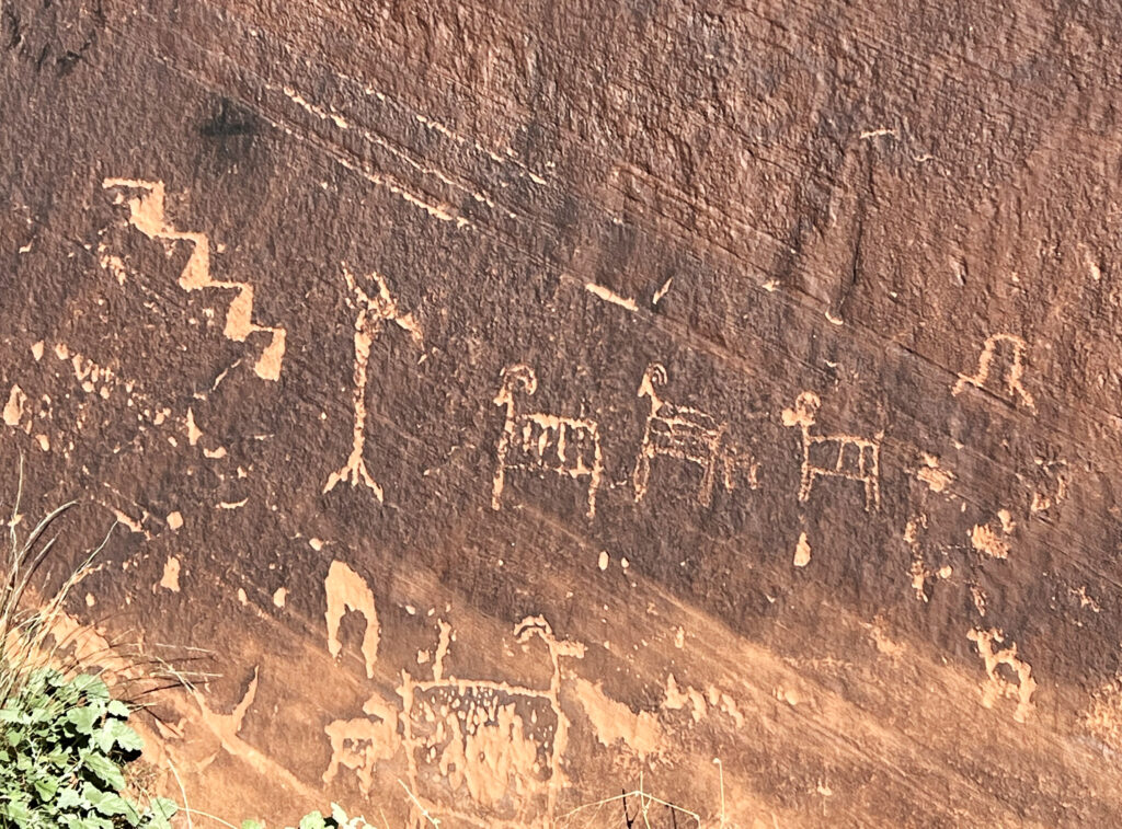
About half way through our trip, we stopped at Boaters’ Beach which is just short of Horseshoe Bend. We took a short hike to see petroglyphs, stone carvings (vs. paintings) in rock. When the outer surface of the rock is chipped away, lighter rock underneath is exposed. The ones pictured below are known as the Descending Sheep Petroglyph Panel and are estimated to be between 3,000 and 6,000 years old. They are symbols meant to communicate messages and ideas.
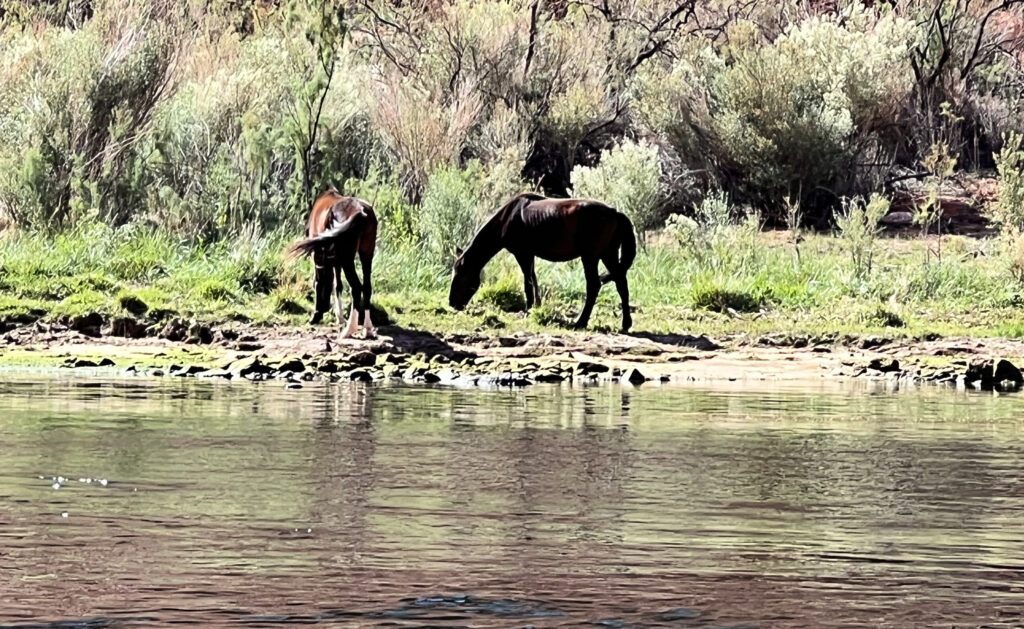
After our short hike to see the petroglyphs, we reboarded our raft and continued down the Colorado River. The first picture was near where we entered Horseshoe Bend. We also saw feral horses – two are pictured here. The last three pictures are ones near the end of the float trip, when we were approaching Lee’s Ferry. The float trip was one of my favorite parts of the America’s Canyonland tour – it was peaceful with beauty at every turn.