The Grand Canyon
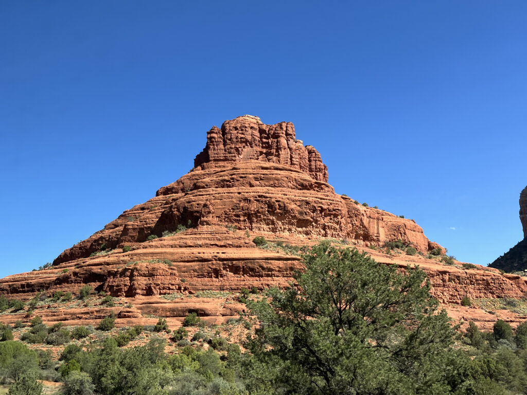
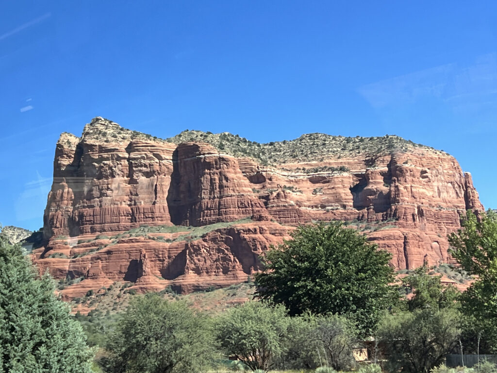
We left Scottsdale and began driving to the South Rim of the Grand Canyon. On the way, we made a lunch stop in Sedona, Arizona. Sedona is famous for its red rocks. I found this explanation of how these beautiful formations came to be.
Before the red rock was turned into rock, it was all soft mud and sand. Over a 320 million year period changes in nature helped transform the sand and mud into something more beautiful than we could have imagined. Sea levels rose and fell during this time and with each rise and fall mud was added. During the sea level rise the mud would be washed in and then when it receded the wind brought in layers of sand. After years of this happening over and over again, the sediment was lithified (transformed) into hard rock. The hard rock had a thin layer of iron oxide that was caused by chemical weathering of natural minerals. The process of the iron oxide weathering turned the rock (into) its signature red color.
https://enjoyorchardcanyon.com/the-story-of-the-red-rock-in-sedona/
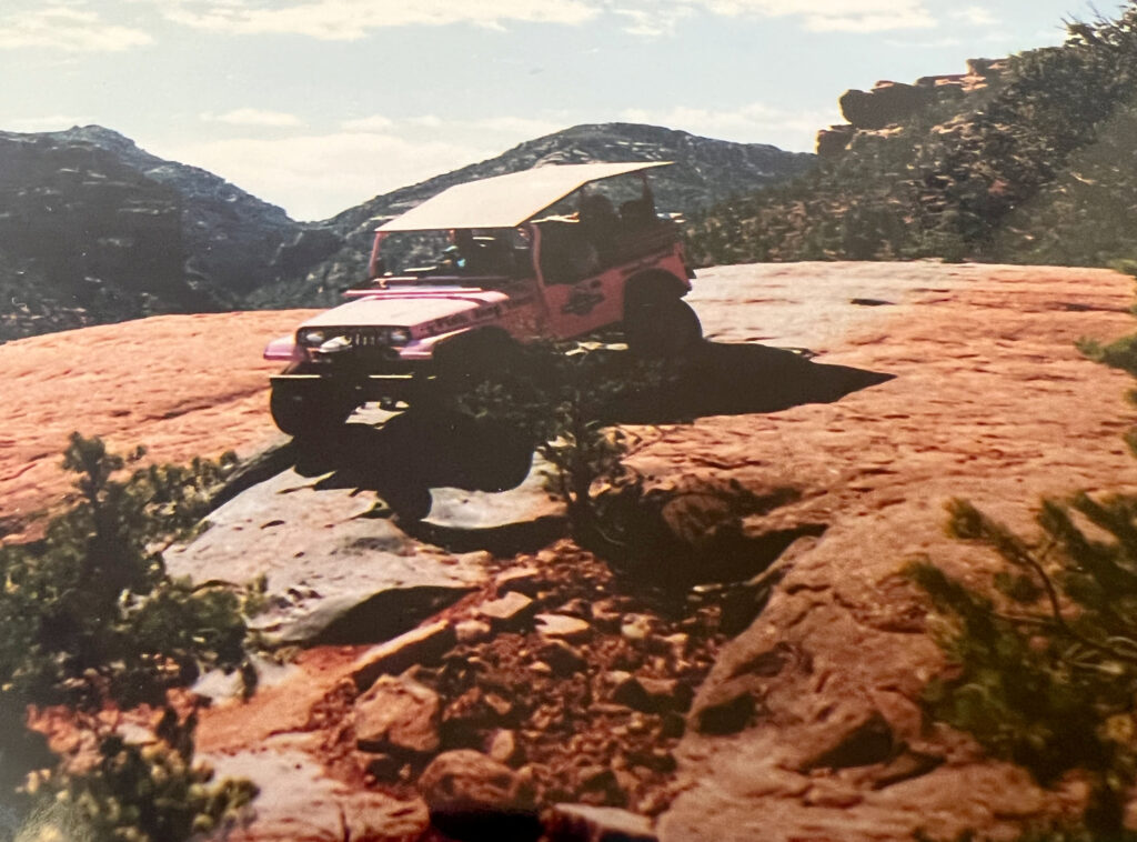
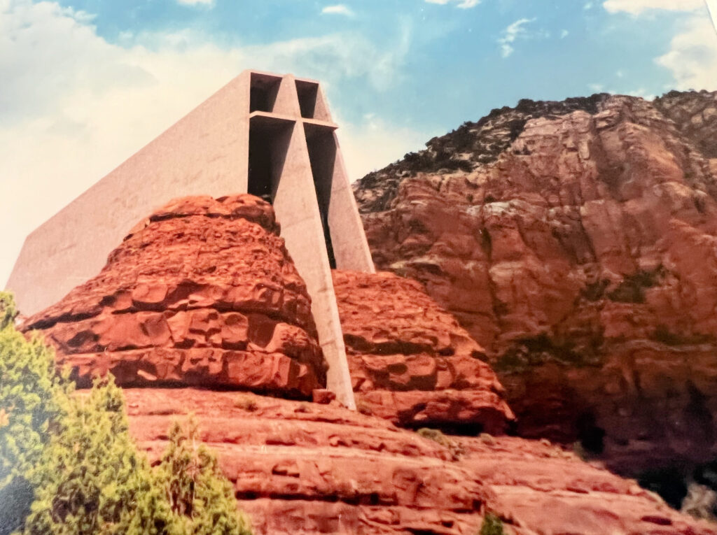
While we were here for just a short time on this trip, our family visited Sedona for a few days almost 30 years ago. One of the highlights of our trip (our kids still talk about it) was a Pink Jeep Tour. We also visited the Chapel of the Holy Cross Church, built into the Sedona rock. It was completed in 1956. There is clear glass behind the altar – there is no need for stained glass windows with the beautiful mountain view.

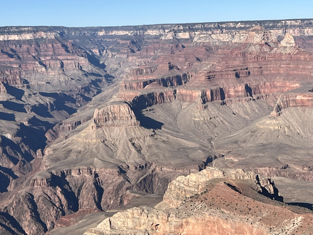
We continued our drive and got our first views of the Grand Canyon at Mather Point. The Grand Canyon was named a UNESCO World Heritage Site in 1979. The internet has multiple sites explaining how the Grand Canyon was formed. I will attempt a very simplified version of what I read. Millions of years ago layers of sediment were deposited by oceans. As the oceans receded, sand was deposited from the shore and sand dunes. This formed layers of rock, most at sea level because the land sank. Then tectonic plates collided, pushing up the area that is now the Grand Canyon. The Colorado River eroded some of the rock, cutting through it and forming the canyon. Water and wind erosion continue to widen the Grand Canyon today. The layers of different colored rock tell this story with those at the bottom being what happened first, and the top layers a result of more recent geological events.


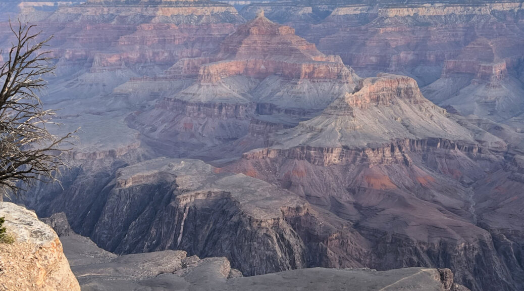
We continued on to our hotel, the Kachina Lodge, which was inside the park and just steps from the Rim Trail. As we walked to dinner at El Tovar (dating back to 1905), we took some pictures and saw how different the canyon walls looked with and without sun shining on them.

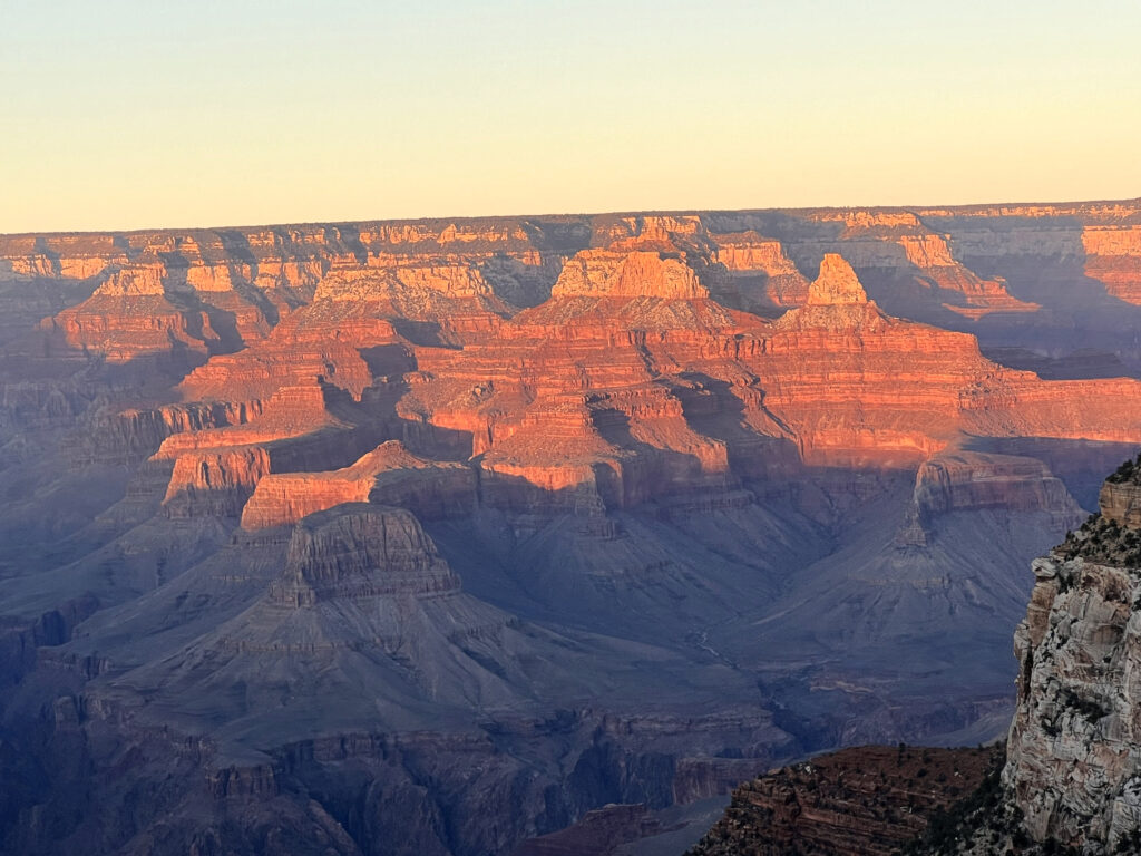
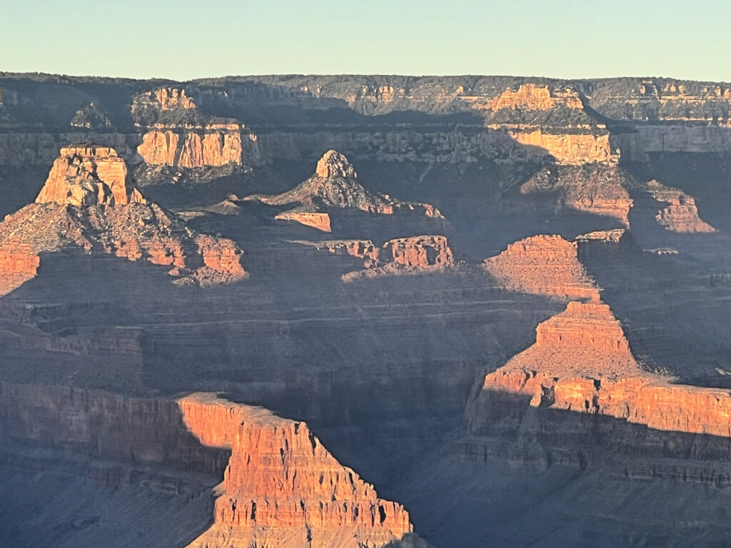
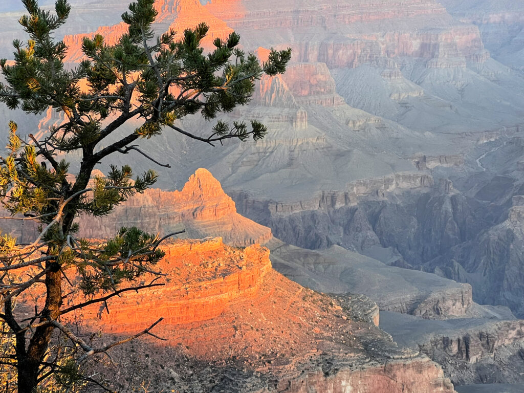
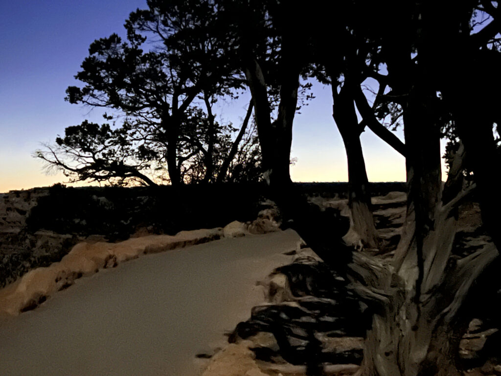
Our tour director recommended we hike to Yavapai Point to see the Grand Canyon at sunrise, about a 1 1/2 mile hike. We headed out about 5:30 and, with some stops along the way, made it to Yavapai Point at 6:30, just a few minutes before the official sunrise. These pictures are ones I took on the way to Yavapai Point.


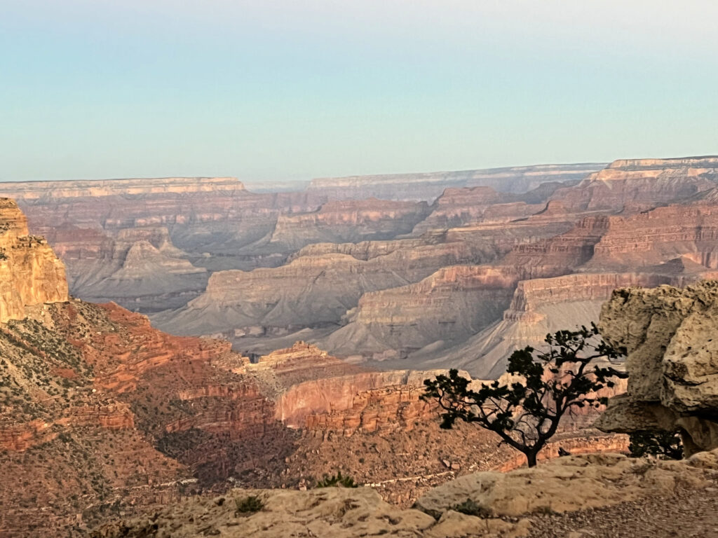

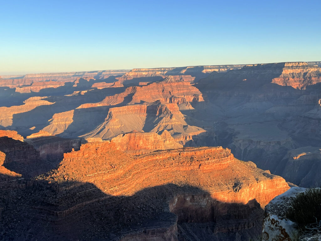
And these are the ones I took at and after sunrise. It was a very early morning and a long hike at almost 7,000 feet – but the views were beautiful!